 |
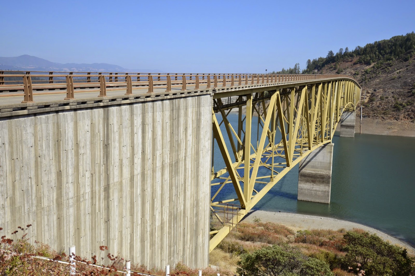
| September 2014 (38.71500 Degrees, -123.01583 Degrees) Rockpile Road Bridge |
It looks like the superstructure is attached to the piers with two bearings and a damper in the center to absorb energy for wind and earthquake loads. Hopefully the county has performed an analysis for this bridge to ensure it can resist a large earthquake on the San Andreas Fault (20 miles away) and the Healdsburg fault (2 miles away). Sonoma County performed a strategic planning assessment of its bridges following the I-35 bridge collapse. Their report can be found on this website.


Sonoma County, California Bridges: Rockpile Road Bridge across Warm Springs Creek (2) by MarkYashinsky is licensed under a Creative Commons Attribution-NonCommercial-NoDerivatives 4.0 International License.
No comments:
Post a Comment