Wednesday, February 29, 2012

Sichuan, China's Bridges: Mianyang Airport Viaduct

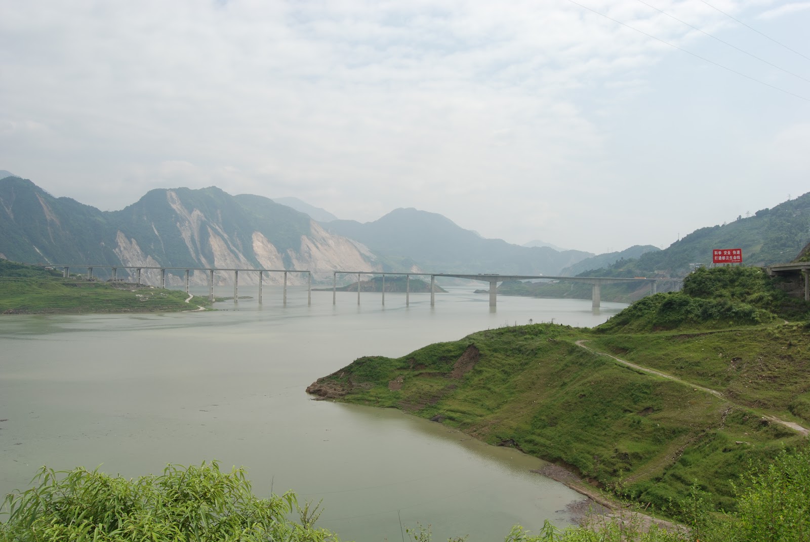
July 2008 (31.4223°N, 104.7533°E) Mianyang Airport Viaduct
For my last bridge photo from Sichuan, China I picked this 'U' shaped ramp that allows vehicles to drop off and pick up people at the Mianyang Airport. However, it is such an irregular design, with columns that increase in diameter, or are half the height of adjacent columns, that its great distance from the earthquake is the only reason more damage didn’t occur. The center part of the ‘U’ is a double deck bridge that allows vehicles access to both airport levels.  A short, stiff column had severe shear cracks that exposed the aggregate and reinforcement. Also, there was spalling of the superstructure concrete at the expansion joint at the next column. The Airport Viaduct remained closed for more than two months after the earthquake.


I'm flying to Japan today to attend a symposium on last year's earthquake and tsunami. Hopefully, I'll have time to add some more Tokyo river bridges to my blog. If I'm too busy (or too exhausted) I'll put them in after I return.
Creative Commons License
Sichuan, China's Bridges: Mianyang Airport Viaduct by Mark Yashinsky is licensed under a Creative Commons Attribution-NonCommercial-ShareAlike 3.0 United States License.

Tuesday, February 28, 2012

Sichuan, China's Bridges: Ming River Bridges in Ying Xiu Village

July 2008 (31.065 Degrees, 103.4902 Degrees) Ming River Bridges
Drove into Yinchiou Village, which was destroyed by the earthquake.  After lunch we walked to the Ming Jing River, where several bridges, a river levee, a tunnel, as well as many buildings were damaged due to ground shaking, landslides, and a surface rupture.  A viaduct on the east side of the river collapsed due to a surface rupture.  A tunnel going into the mountains east of the river also was damaged by the offset.  A levee on the west side of the river and several buildings were destroyed by the fault which was estimated to have a vertical offset of about 1.5 meters.  About 500 meters north of the fault, the Ying Xiu Ming Jiang Bridge, a T-girder bridge on two-column bents that are supported on pile shafts had some damage due to a landslide at the east span and so the Sichuan Province Government has built a Bailey Bridge over the east span to carry vehicles over the damage.  A steel suspension bridge another 500 yards north of this bridge appears undamaged by the earthquake. 
Creative Commons License
Sichuan, China's Bridges: Ming River Bridges in Ying Xiu Village by Mark Yashinsky is licensed under a Creative Commons Attribution-NonCommercial-ShareAlike 3.0 United States License.

Monday, February 27, 2012

Sichuan China's Bridges: Shoujiang Bridge

 July 2008 (30.9800°N, 103.4605°E) Shoujiang Bridge

The Shoujiang Bridge is an eight-span, 280-m-long, T-girder bridge supported on very tall two-column towers and pier walls. The tallest piers were approximately 60 m high, the approach spans were 30 m long, and the four main spans were 40 m long. Both the towers and the pierwalls were supported on pile foundations. The north span almost fell off the north tower and was supported by a temporary steel tower. A Bailey bridge had been launched over the north span to carry the traffic. The north approach embankment showed evidence of ground failure, and there was a shear failure of the north abutment. It appeared that too much movement of this very tall structure pushed the girders of the first span into the approach and almost off the tower. It is unclear if the hazard was faulting, a landslide, or ground shaking. The most serious vulnerability was the short seat that could not accommodate the resulting movement at Bent 2.
Creative Commons License
Sichuan China's Bridges: Shoujiang Bridge by Mark Yashinsky is licensed under a Creative Commons Attribution-NonCommercial-ShareAlike 3.0 United States License.

Sunday, February 26, 2012

Sichuan China's Bridges: Wenchuan Route 213 Bridge

July 2008 (31.0317°N, 103.4682°E) Bridge near Wenchuan
We are entering the area around Yingchiou where some of the strongest shaking and major bridge damage from the 2008 earthquake occurred. This is a very tall four span river crossing. The T-girder superstructure is supported on very tall RC two column towers.  There was so much movement and damage, that a long Bailey Bridge was launched over the existing superstructure to support the traffic. It looked like the north span may have come close to dropping and the small exterior shear keys were knocked over. The People's Army did a good making use of Bailey Bridges to keep these mountain roads open after the earthquake.
Creative Commons License
Sichuan China's Bridges: Wenchuan Route 213 Bridge by Mark Yashinsky is licensed under a Creative Commons Attribution-NonCommercial-ShareAlike 3.0 United States License.

Saturday, February 25, 2012

Sichaun China's Bridges: Minjiang Arch Bridge

July 2008 31.025 Degrees, 103.575 Degrees) Minjiang Arch Bridge
On the upstream side of the Zipindpu Dam is the damaged Miao Zi Ping Bridge, but on the downstream side is an undamaged two span through arch bridge over the Minjiang. This photo was taken by Francis and David and shown on their Treasurethouhast Flickr website. I guess the lack of damage shows the variability of ground shaking. Also, the Miao Zi Ping Bridge was closest to the fault rupture and had the most damage, while the dam was a little further away and had less damage, and this arch bridge was still further away and had no damage.

Friday, February 24, 2012

Sichuan China's Bridges: Miao Zi Ping Bridge (5)

July 2008 (31.021 Degrees, 103.544 Degrees) Miao Zi Ping Bridge
During the earthquake, the end of one of the continuous five span T girder superstructures was pulled backward until it came off its bearings and fell into the reservoir. Was this the result of ground shaking, liquefaction, or ground movement? Divers reported that the piles were damaged. There was a permanent offset at the expansion joints of about half a meter (see below). The main fault trace was several miles away so I'll say the damage was due to ground shaking.
The damaged piles were replaced, a new span was added, the expansion joints were repaired. The Duwan highway was completed a few months later than was originally anticipated.
Creative Commons License
Sichuan China's Bridges: Miao Zi Ping Bridge (5) by Mark Yashinsky is licensed under a Creative Commons Attribution-NonCommercial-ShareAlike 3.0 United States License.

Thursday, February 23, 2012

Sichuan China's Bridges: Miao Zi Ping Bridge (4)

July 2008 (31.021 Degrees, 103.544 Degrees) Miao Zi Ping Bridge
A look back at the complicated geometry at the south approach to the Miao Zi Ping Bridge. The Duwen Highway goes through a tunnel and crosses under a three span bridge before taking traffic onto the bridge. All of these highway structures were damaged during the earthquake.
Creative Commons License
Sichuan China's Bridges: Miao Zi Ping Bridge (4) by Mark Yashinsky is licensed under a Creative Commons Attribution-NonCommercial-ShareAlike 3.0 United States License.

Wednesday, February 22, 2012

Sichuan China's Bridges: Miao Zi Ping Bridge (3)

July 2008 (31.021 Degrees, 103.544 Degrees) Miao Zi Ping Bridge
Another view of the Miao Zi Ping Bridge. This was part of a massive infrastructure project to provide access between the Sichuan Plain and the Tibetan Plateau. However, the bridges were designed with few seismic details despite crossing one of the most highly seismic regions on the planet. Billions of Yuans (RMB) of infrastructure was destroyed, but the damage was quickly removed and construction continued unabated, usually to the same standards as the original structures.
Creative Commons License
Sichuan China's Bridges: Miao Zi Ping Bridge (3) by Mark Yashinsky is licensed under a Creative Commons Attribution-NonCommercial-ShareAlike 3.0 United States License.

Tuesday, February 21, 2012

Sichuan China's Bridges: Miao Zi Ping Bridge (2)

July 2008 (31.021 Degrees, 103.544 Degrees) Miao Zi Ping Bridge
This photo has an almost painterly quality about it. Maybe because I took it from the window of a fast-moving Chinese Government SUV.

China is an interesting country where the individual and society have a different relationship than in the west. For instance, this reservoir is part of the Minjiang River, which was dammed for the good of society as a whole. Those individuals who lived along the river had little recourse but to rebuild their lives somewhere else. Maybe that's not so different from what the Tennessee Valley Authority did in the United States during the Depression?
Creative Commons License
Sichuan China's Bridges: Miao Zi Ping Bridge (2) by Mark Yashinsky is licensed under a Creative Commons Attribution-NonCommercial-ShareAlike 3.0 United States License.

Monday, February 20, 2012

Sichuan China's Bridges: Miao Zi Ping Bridge (1)

July 2008 (31.021 Degrees, 103.544 Degrees) Miao Zi Ping Bridge
Drove on the Dujianyan to Wenchuan (Duwen) Highway to the Miao Zi Ping Bridge, which crosses the Zi Ping Pu Reservoir, created by damming the Min River.  This bridge has an RC box girder main span on single column towers and T-girder approach spans on two-column bents. The bridge was completely constructed except for installing the expansion joints at the time of the earthquake. 

The most severe damage was to the end span of a continuous five-span T-girder segment that broke and fell off the supporting bent caps during the earthquake.  There were other indications of large longitudinal movement. The barrier rails overlapped by about 300 cm at the southeast expansion joint. Divers found cracks at the bottom of the main span columns.
Creative Commons License
Sichuan China's Bridges: Miao Zi Ping Bridge (1) by Mark Yashinsky is licensed under a Creative Commons Attribution-NonCommercial-ShareAlike 3.0 United States License.

Sunday, February 19, 2012

Sichuan China's Bridges: Zipingpu Arch Bridge in Dujiangyan

July 2008 (31.038 Degrees, 103.578 Degrees) Zipingpu Arch Bridge
Next to the Zipingpu Dam is this single span deck arch bridge. The dam suffered moderate damage during the 2008 earthquake but fortunately it didn't fail. There were landslides above the bridge but the embankments were well anchored and suffered little damage. 
Creative Commons License
Sichuan China's Bridges: Zipingpu Arch Bridge in Dujiangyan by Mark Yashinsky is licensed under a Creative Commons Attribution-NonCommercial-ShareAlike 3.0 United States License.

Saturday, February 18, 2012

Sichuan China's Bridges: Xiao Yu Dong (Fish Hole) Bridge (4)

July 2008 (31.185 Degrees, 103.765 Degrees) Xiao Yu Dong Bridge
A last look at the 'Fish Hole' bridge. The bridge deck has been pushed up onto the embankment by the fault movement. The mountains in the background are covered in landslides due to the shaking.
Creative Commons License
Sichuan China's Bridges: Xiao Yu Dong (Fish Hole) Bridge (4) by Mark Yashinsky is licensed under a Creative Commons Attribution-NonCommercial-ShareAlike 3.0 United States License.

Friday, February 17, 2012

Sichuan China's Bridges: Xiao Yu Dong (Fish Hole) Bridge (3)

July 2008 (31.185 Degrees, 103.765 Degrees) Xiao Yu Dong Bridge
Another view of the 'Fish Hole' Bridge. The two spans on the left side of the bridge collapsed and the rest of the bridge was severely damaged. The bent cap seats were about 34 inches wide and so there was only about a 12 inches to support the girders on each side, which was smaller than the fault offset.  As the right end of the bridge was lifted up onto the abutment, the rest of the bridge was pulled over and collapsed.

Creative Commons License
Sichuan China's Bridges: Xiao Yu Dong (Fish Hole) Bridge (3) by Mark Yashinsky is licensed under a Creative Commons Attribution-NonCommercial-ShareAlike 3.0 United States License.

Thursday, February 16, 2012

Sichuan China's Bridges: Xiao Yu Dong (Fish Hole) Bridge (2)

July 2008 (31.185 Degrees, 103.765 Degrees) Xiao Yu Dong Bridge
Another photo at the north end of the 'Fish Hole' Bridge. Questions about the cause of the damage resulted in animated discussions among the team members. Curt (the only student on the team) came up with the most reasonable solution. He showed (in figure below) that during the earthquake the hanging wall pushed the superstructure into the abutment, causing the fixed connections to snap like twigs.

Creative Commons License
Sichuan China's Bridges: Xiao Yu Dong (Fish Hole) Bridge (2) by Mark Yashinsky is licensed under a Creative Commons Attribution-NonCommercial-ShareAlike 3.0 United States License.

Wednesday, February 15, 2012

Sichuan China's Bridges: Xiao Yu Dong (Fish Hole) Bridge (1)

(31.185 Degrees, 103.765 Degrees) Xiao Yu Dong Bridge
Xiao Yu Dong (Fish Hole) Bridge was a four span R.C. arch bridge with long approaches built in the 1980s.  It took us a while to realize that the thrust fault was under the bridge and its offset compressed the superstructure, forcing the deck to slide over the top of the abutment.

Creative Commons License
Sichuan China's Bridges: Xiao Yu Dong (Fish Hole) Bridge (1) by Mark Yashinsky is licensed under a Creative Commons Attribution-NonCommercial-ShareAlike 3.0 United States License.

Tuesday, February 14, 2012

Sichuan China's Bridges: Seven Span River Crossing North of Penzhou

July 2008 (31.1218°N, 103.850°E) Seven Span River Crossing North of Penzhou
North of Pengzhou we drove past a seven span T-girder river crossing on pier walls.  The approaches had settled about half a meter.  No shear key damage.   The People's Army was repairing the steel railing as we drove by. The army did a good job of helping people in the isolated mountain villages after the disaster. There was a lot of building damage around this bridge.
Creative Commons License
Sichuan China's Bridges: Seven Span River Crossing North of Penzhou by Mark Yashinsky is licensed under a Creative Commons Attribution-NonCommercial-ShareAlike 3.0 United States License.

Monday, February 13, 2012

Sichuan China's Bridges: South Nin River Bridge in Mianyang

July 2008 (31.4502°N, 104.7503°E) South Nin River Bridge
Another open spandrel arch bridge, this one in Mianyang. The South Nin River Bridge is a six-span arch bridge with an additional slab bridge at the north end. During the earthquake, some of the haunched girders atop the spandrel columns cracked at midspan, probably due to excessive column movement.
Creative Commons License
Sichuan China's Bridges: South Nin River Bridge in Mianyang by Mark Yashinsky is licensed under a Creative Commons Attribution-NonCommercial-ShareAlike 3.0 United States License.

Sunday, February 12, 2012

Sichuan China's Bridges: Fujiang River Bridge

July 2008 (31.888 Degrees, 104.783 Degrees) Fujiang River Bridge
We crossed many new bridges in excellent shape along Route S105 on our way back from Nanba. Eventually we stopped at the Fujiang River, which was dammed by landslides during the earthquake. They had to evacuate all of the people downstream before they blew up the 'quake' dam, just in case anything went wrong. Across the Fujiang River was this long, open spandrel arch bridge. It seems like they often build the same piers on top of caissons in many rivers, and then choose the type of superstructure based on materials, availability of skilled labor, or on span length. But it's usually an arch. 
Creative Commons License
Sichuan China's Bridges: Fujiang River Bridge by Mark Yashinsky is licensed under a Creative Commons Attribution-NonCommercial-ShareAlike 3.0 United States License.


Saturday, February 11, 2012

SIchuan China's Bridges: Nanba Bridges

July 2008 (32.2095°N, 104.8292°E) Nanba Bridges
We eventually arrived in Nanba, 120 miles north of Chengdu where an existing three span arch river crossing had collapsed.  Also, a ten span river crossing under construction had dropped most of its precast voided slab spans into the river and the two-column bents had been distorted.  A temporary structure was being constructed by launching Bailey Bridges onto new RC pier walls when we arrived. In the meantime, vehicles were driving across the river on fill material laid over culverts.

Creative Commons License
Sichuan China's Bridges: Nanba Bridges by Mark Yashinsky is licensed under a Creative Commons Attribution-NonCommercial-ShareAlike 3.0 United States License.

Friday, February 10, 2012

Sichuan China's Bridges: Baiyun Bridge in Mianyung (3)

July 2008 (31.4547°N, 104.7177°E) Baiyun Bridge
Mianyung is a very pretty city. In this photo you can see the dam upstream  that turns this river into a lake. I went under the bridge to photograph the girders and immediately became covered in mud. A family made homeless by the earthquake came over and gave me a bucket of water to clean off in. However, I accidentally dropped my Leica camera in the bucket and had to use my cell phone to photograph bridges the rest of the trip.
Creative Commons License
Sichuan China's Bridges: Baiyun Bridge in Mianyung (2) by Mark Yashinsky is licensed under a Creative Commons Attribution-NonCommercial-ShareAlike 3.0 United States License.

Thursday, February 9, 2012

Sichuan China's Bridges: Baiyun Bridge in Mianyung (2)

July 2008 (31.4547°N, 104.7177°E) Baiyun Bridge
A view from the deck of the Baiyun Bridge in Mianyung. Unlike some recent tied arches we've studied, this bridge has stiffened girders between the arches. Perhaps that's why there was little damage.

Mianyung was a nice town with little bridge damage but there must have been quite a bit of building damage since there were many relief camps around town.
Creative Commons License
Sichuan China's Bridges: Baiyun Bridge in Mianyung (2) by Mark Yashinsky is licensed under a Creative Commons Attribution-NonCommercial-ShareAlike 3.0 United States License.

Wednesday, February 8, 2012

Sichuan China's Bridges: Baiyun Bridge in Mianyung (1)

July 2008 (31.4547°N, 104.7177°E) Baiyun Bridge
Baiyun Bridge is a three span, simply supported, arch bridge with prestressed tendons at the deck to keep the arch in compression.  The arches are supported on four-column bents and seat type abutments.  After the earthquake, oil in the tendon ducts began to leak, suggesting that the ducts had developed cracks during the earthquake (or possibly the anchorages were damaged).  Also, there was some spalling of the deck around the arches and cables.  Mianyung was in the plains and far from the area of strong shaking.
Creative Commons License
Sichuan China's Bridges: Baiyun Bridge in Mianyung (1) by Mark Yashinsky is licensed under a Creative Commons Attribution-NonCommercial-ShareAlike 3.0 United States License.

Tuesday, February 7, 2012

Sichuan China's Bridges: Kon Chi Doug Cho Bridge

July 2008 (31.161°, 103.828°) Kon Chi Doug Cho Bridge
Driving north from Pengzhou we came to the Kon Chi Doug Cho Bridge, an 11 span closed spandrel arch on concrete pier walls that was built in 1970.  Considering the many masonry arch bridges that collapsed during the Wenchuan earthquake, it was surprising to find this bridge still standing.  All we could find was minor pounding damage at the railing and some approach settlement. It's interesting that these brittle arch spans sit on such sturdy concrete piers. Also that this medieval looking bridge was built in 1970.
Creative Commons License
Sichuan China's Bridges: Kon Chi Doug Cho Bridge by Mark Yashinsky is licensed under a Creative Commons Attribution-NonCommercial-ShareAlike 3.0 United States License.