Wednesday, October 31, 2012

Miyagi Japan's Bridges: Tsuya Railway Bridge (1)

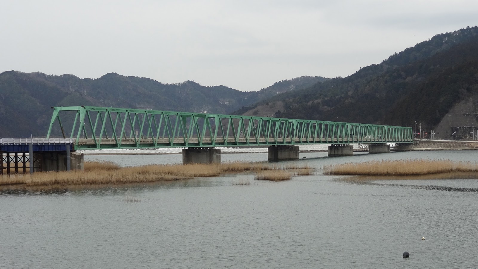
March 2012 (38.769 Degrees, 141.507 Degrees) Tsuya Railway Bridge
The next location is in northern Miyagi Prefecture at the Tsuya River. There was a lot of damage at his location including to this railway. We'll take a closer look at the railway damage tomorrow.

Creative Commons License
Miyagi Japan's Bridges: Tsuya Railway Bridge (1) by Mark Yashinsky is licensed under a Creative Commons Attribution-NonCommercial-ShareAlike 3.0 License.

Tuesday, October 30, 2012

Miyagi, Japan's Bridges: The Utatsu Bridge (3)

March 2012 (38.716 Degrees, 141.523 Degrees) Utatsu Bridge
A couple of interesting things about the Utatsu Bridge. It appears that there was some ground shaking damage to this bridge before the tsunami. This short, stiff column may have been damaged due to rotation of the hammerhead bent cap before the tsunami struck the mainland.
Also, the other end of the bridge (across the bay) didn't lose its superstructure. The two ends survived intact while the middle of the bridge was washed away as seen in the Google Earth photo below.
Creative Commons License
Miyagi, Japan's Bridges: The Utatsu Bridge (3) by Mark Yashinsky is licensed under a Creative Commons Attribution-NonCommercial-ShareAlike 3.0 License.

Monday, October 29, 2012

Miyagi, Japan's Bridges: The Utatsu Bridge (2)

March 2012 (38.716 Degrees, 141.523 Degrees) Utatsu Bridge
A couple of interesting things about the Utatsu Bridge. The bridge was retrofitted with concrete casings around the bents and steel shear keys between the girders. Most highway bridges in Japan got a very thorough seismic retrofit after the 1995 Kobe earthquake. However, bridges in Japan (and in the United States) haven't been retrofitted for tsunami.
Creative Commons License
Miyagi, Japan's Bridges: The Utatsu Bridge (2) by Mark Yashinsky is licensed under a Creative Commons Attribution-NonCommercial-ShareAlike 3.0 License.

Sunday, October 28, 2012

Miyagi, Japan's Bridges: The Utatsu Bridge (1)

March 2012 (38.716 Degrees, 141.523 Degrees) Utatsu Bridge
Continuing north on Route 45 to the town of Utatsu at the north end of the bay, which was devastated by the tsunami. The Utatsu Bridge has a long I girder superstructure on hammerhead piers that carried Route 45 along the shore and over the river. The spans over the river seem to be okay, but the spans along the bay were washed away.
We'll take a closer look at this bridge tomorrow.
Creative Commons License
Miyagi, Japan's Bridges: The Utatsu Bridge (1) by Mark Yashinsky is licensed under a Creative Commons Attribution-NonCommercial-ShareAlike 3.0 License.

Saturday, October 27, 2012

Miyagi, Japan's Bridges: Sakuragawa Railway Bridge (2)

March 2012 (38.691, 141.488) Sakuragawa Railway Bridge    
Continuing north on Route 45 we drove past the Sakuragawa Railway Bridges that is shown on the blog for October 16th (we stopped to photograph this bridge at the end of our trip).
Creative Commons License
Miyagi, Japan's Bridges: Sakuragawa Railway Bridge (2) by Mark Yashisnky is licensed under a Creative Commons Attribution-NonCommercial-ShareAlike 3.0 License.

Friday, October 26, 2012

Miyagi, Japan's Bridges: Bridges over the Hachiman River (2)

March 2012 (38.675 Degrees, 141.448 Degrees) Highway 221 Bridge
Continuing north on Route 45 we arrive back at the Hachiman River that was previously studied on October 16th. Most of the buildings were washed away except for their concrete foundations.
Creative Commons License
Miyagi, Japan's Bridges: Bridges over the Hachiman River (2) by Mark Yashinsky is licensed under a Creative Commons Attribution-NonCommercial-ShareAlike 3.0 License.

Thursday, October 25, 2012

Miyagi Japan's Bridges: Oritachi Bridge in Minami Sanriku


March 2012 (38.647, 141.437) The Oritachi Bridge
Driving north from the Kitakami Bridge, Route 45 cuts inland before returning to the ocean in the Minami Sanriku District at Sakuragawa Bay. The entire district was damaged by the tsunami including at this location. 

The floodgates (behind the building in the photo below) were damaged and the area was inundated by the waves. The Oritachi Bridge was washed away (where a blue replacement bridge can be seen on the right side of the photo). The Oritachi Bridge was a two span precast girder bridge that was completed in 1992.
The last photo shows how the area looked immediately after the tsunami. The floodgates can be seen in the background and the Oritachi Bridge (minus the superstructure and approaches) is in the foreground.
Creative Commons License
Miyagi Japan's Bridges: Oritachi Bridge in Minami Sanriku by Mark Yashinsky is licensed under a Creative Commons Attribution-NonCommercial-ShareAlike 3.0 License.

Wednesday, October 24, 2012

Miyagi, Japan's Bridges: Kitakami River Bridge (9)

March 2012 (38.547 Degrees, 141.423 Degrees) Kitakami Bridge
A last few photos of the Kitakami Bridge. The truss spans that remained were still attached to HDPE-wrapped cable restrainers between the floor beams and the piers.
The photo below shows a plaque giving the dates for design and construction of this bridge. I wonder if the Ministry is planning on replacing it?  In the previous photos we saw construction equipment and activity just upstream.

Starting tomorrow, we'll head north on Route 45 to look at some more tsunami-damaged and repaired bridges.
Creative Commons License
Miyagi, Japan's Bridges: Kitakami River Bridge (9) by Mark Yashinsky is licensed under a Creative Commons Attribution-NonCommercial-ShareAlike 3.0 License.

Tuesday, October 23, 2012

Miyagi, Japan's Bridges: Kitakami River Bridge (8)

March 2012 (38.547 Degrees, 141.423 Degrees) Kitakami Bridge
A few more photos of the damaged abutment on the Kitakami Bridge. Bridge owners are now wondering if it's possible to design seat-type abutments that can securely anchor the superstructure during tsunami.
Creative Commons License
Miyagi, Japan's Bridges: Kitakami River Bridge (8) by Mark Yashinsky is licensed under a Creative Commons Attribution-NonCommercial-ShareAlike 3.0 License.

Monday, October 22, 2012

Miyagi, Japan's Bridges: Kitakami River Bridge (7)

March 2012 (38.547 Degrees, 141.423 Degrees) Kitakami Bridge
We saw in a previous blog how the truss spans had been scarred by debris carried by the tsunami. However as seen in the photo above the five southeastern spans remained on their piers and were still functional. The waves must have been higher and faster along the northwest shore where the spans were carried upstream. Note the damaged concrete shear keys, cable restrainers, and broken bearings on the abutment and pier.
The missing spans were originally supported on the bank that is  dry during low tide (see photo below).
Creative Commons License
Miyagi, Japan's Bridges: Kitakami River Bridge (7) by Mark Yashinsky is licensed under a Creative Commons Attribution-NonCommercial-ShareAlike 3.0 License.

Sunday, October 21, 2012

Miyagi, Japan's Bridges: Kitakami River Bridge (6)

March 2012 (38.547 Degrees, 141.423 Degrees) Kitakami Bridge
To avoid the damaged substructure elements on the Kitakami Bridge, the new spans step around them. The barrier rail snakes over these steps to form a two-lane bridge deck. I guess that's how you make a curved alignment out of straight superstructure segments.  That explains the odd placement of the new spans.  However, I'm still unsure why plastic pipes are sticking out of the ground in the photo below.
Creative Commons License
Miyagi, Japan's Bridges: Kitakami River Bridge (6) by Mark Yashinsky is licensed under a Creative Commons Attribution-NonCommercial-ShareAlike 3.0 License.

Saturday, October 20, 2012

Miyagi, Japan's Bridges: Kitakami River Bridge (5)

March 2012 (38.547 Degrees, 141.423 Degrees) Kitakami Bridge
Looking up (into the sun) at the broken members that once connected two trusses of the Kitakami Bridge.  The purpose of these elements was carefully explained to me, but now I've forgotten the explanation. The next truss span was dragged from its piers and so these top members were broken.
A photo of the damaged abutment, which was subsequently abandoned. Note the various devices that were meant to keep the truss seated that were broken as it was carried away. Also note the replacement bridge spans (with blue girders) behind the abutment. The Ministry was able to quickly drive piles and set these replacement spans onto Route 45 while they pondered the future for this region.
Creative Commons License
Miyagi, Japan's Bridges: Kitakami River Bridge (5) by Mark Yashinsky is licensed under a Creative Commons Attribution-NonCommercial-ShareAlike 3.0 License.

Friday, October 19, 2012

Miyagi, Japan's Bridges: Kitakami River Bridge (4)

March 2012 (38.547 Degrees, 141.423 Degrees) Kitakami Bridge

Three views of damage to the truss members of the Kitakami Bridge, most likely from wave-borne debris during last year's tsunami.
Creative Commons License
Miyagi, Japan's Bridges: Kitakami River Bridge (4) by Mark Yashinsky is licensed under a Creative Commons Attribution-NonCommercial-ShareAlike 3.0 License.

Thursday, October 18, 2012

Miyagi, Japan's Bridges: Kitakami River Bridge (3)

March 2012 (38.547 Degrees, 141.423 Degrees) Kitakana Bridge
Some more photos of the Kitakana Bridge, which lost several spans during the Tohoku earthquake. New steel girder spans have replaced the lost truss spans at the north end of the bridge. They built the new spans next to the old substructure and so the deck veers to the east to avoid them (as seen on the bus driving up to the site).
A year later you can still see the old truss spans in the river a few hundred feet upstream. Perhaps in Japan they leave the remnants of past disasters as reminders to the public.
Creative Commons License
Miyagi, Japan's Bridges: Kitakami River Bridge (3) by Mark Yashinsky is licensed under a Creative Commons Attribution-NonCommercial-ShareAlike 3.0 License.