Sunday, March 31, 2013

Amador County Bridges: State Route 124 Highway Bridge across Dry Creek (3)

March 2013 (38.42888 Degrees, -120.87667 Degrees) Dry Creek Bridge
A few last photos of the State Route 124 Bridge across Dry Creek. The main span is 143 ft long and the bridge is 375 ft long. Timber planking was placed in each bay to help the area bridge maintenance engineer inspect the girders (and for painting). The columns are on oversized shafts to force plastic hinging above ground during a large earthquake. There's a lot of rubble between each column and the river to protect against scour.
The National Bridge Inventory classifies SR 124 as a minor (rural) arterial route but average daily traffic has been steadily increasing from 1300 vehicles in 1990 to 3550 in 2010. This is the only highway going northwest to southeast through the county and traffic was constant while I was photographing the bridge. The bridge is 42 ft wide from edge of deck to edge of deck with two lanes and wide shoulders.
Dry Creek is a major obstacle for highways and roads located in the western part of Amador County. Over the next few days we'll look at some of the other Dry Creek Bridges.
Creative Commons License
Amador County Bridges: State Route 124 Highway Bridge across Dry Creek (3) by Mark Yashinsky is licensed under a Creative Commons Attribution-NonCommercial-ShareAlike 3.0 United States License.

Saturday, March 30, 2013

Amador County Bridges: State Route 124 Highway Bridge across Dry Creek (2)

March 2013 (38.42888 Degrees, -120.87667 Degrees) Dry Creek Bridge
Another view of the State Route 124 Bridge over Dry Creek. They say the bridge was rebuilt in 2007 but I can't tell what's new and what's old. I was thinking that the reconstruction might be a seismic retrofit. For instance, the deck is in three pieces while the girders are continuous. Also, the girders are cast into the abutment backwall instead of being supported on bearings. The bent cap is also odd with separate pedestals below each vertical girder stiffener. Surely these pedestals must have supported the girder ends when they were simple spans?
However, if parts of the bridge are new and other parts are 48 years old it's not noticeable. The whole bridge looks pretty new. The deck looks kind of old, but decks show the most wear and this one is full of patches due to irregularities during construction.
Creative Commons License
Amador County Bridges: State Route 124 Highway Bridge across Dry Creek (2) by Mark Yashinsky is licensed under a Creative Commons Attribution-NonCommercial-ShareAlike 3.0 United States License.

Friday, March 29, 2013

Amador County Bridges: State Route 124 Highway Bridge across Dry Creek (1)

March 2013 (38.42888 Degrees, -120.87667 Degrees) Dry Creek Bridge
From my house it's a 25 mile drive east on the Jackson Highway (State Route 16) to Amador County. Just past the county line the East Plymouth Highway (State Route 124) goes southwest and the Golden Chain Highway (State Route 49) goes southeast from the Jackson Highway (see Google earth photo below). Last week we looked at some bridges built in 2007 on S.R. 49. Today we are going to look at a bridge that was rebuilt in 2007 on S.R. 124. However, unlike the prestressed concrete bridges we previously visited, the Dry Creek Bridge (26 0028) is a continuous span steel girder bridge. We'll take a closer look at it tomorrow.
Creative Commons License
Amador County Bridges: State Route 124 Highway Bridge across Dry Creek (1) by Mark Yashinsky is licensed under a Creative Commons Attribution-NonCommercial-ShareAlike 3.0 United States License.

Thursday, March 28, 2013

Amador County, California Bridges: State Route 49 across Sutter Creek (5)

March 2013 (38.3936 Degrees, -120.8161 Degrees) Sutter Creek Bridge
One last photo of the Sutter Creek Bridge. The new highway was built to bypass Old State Route 49 (around the tourist town of Sutter Creek). We stopped there last Saturday and traffic was very slow through a town with many stop signs (traffic on the new State Route 49 is 65 mph). I asked Eric (the bridge designer) which architect helped with the aesthetics and he said it was Felix Wong who also helped me on several bridge projects. He said Felix picked the reddish barrer rails to match the patches of bare ground in the surrounding landscape.

They did a lot of earth moving to end up with a highway where you can barely register the fact that you're briefly traveling over a bridge that's 140 ft in the air.
Creative Commons License
Amador County, California Bridges: State Route 49 across Sutter Creek (5) by Mark Yashinsky is licensed under a Creative Commons Attribution 3.0 Unported License.

Wednesday, March 27, 2013

Amador County, California Bridges: State Route 49 across Sutter Creek (4)

February 2006 (38.3936 Degrees, -120.8161 Degrees) Sutter Creek Bridge
Some photos taken during the construction of Sutter Creek Bridge. In the photo above, they are assembling the falsework that will be used to support the formwork for the concrete superstructure. Contractors have slowly built up a large supply of forms and falsework that have made cast-in-place concrete bridges the most economical type of bridge that is built in California.
The photo above shows the collapsed falsework that occurred while they were building the forms. Fortunately, no one was hurt and they were able to reassemble the falsework with little delay.
A photo of the completely assembled falsework and formwork taken on September 12, 2006 (over a year after construction began). A temporary steel structure is built around the piers to support the wet concrete. Once the concrete is hardened and the tendons are stressed this temporary structure can be removed and used to build another bridge.
A photo of the completed the stem and soffit pour and workers getting ready to pour the bridge deck. The abutment backwall won't be built until after the deck is poured, the girder tendons are stressed, and the ducts are grouted. They placed epoxy coated rebar on this bridge, which seems strange since we aren't near the ocean or in a snowy region.

Creative Commons License
Amador County, California Bridges: State Route 49 across Sutter Creek (4) by Mark Yashinsky is licensed under a Creative Commons Attribution 3.0 Unported License.

Tuesday, March 26, 2013

Amador County, California Bridges: State Route 49 across Sutter Creek (3)

August 2005 (38.3936 Degrees, -120.8161 Degrees) Sutter Creek Bridge
The designer of the Sutter Creek Bridge (Eric Zechlin) sent me some photos of it being built (the photo above is stitched together). I also downloaded the plans but they were in metric which was confusing (Caltrans tried metric for a few years but then switched back). The deck is 390 meters above mean sea level and the footing is at 350 meters so the bridge is about 130 ft tall. I'm a little surprised they built a 130 ft tall pier on spread footings without any lateral support. I would imagine a large earthquake could knock it over but maybe it would just rock it back and forth.

Tomorrow we'll look at the falsework. Eric told me they had an accident with the falsework but that no one was hurt. 
Creative Commons License
Amador County, California Bridges: State Route 49 across Sutter Creek (3) by Mark Yashinsky is licensed under a Creative Commons Attribution 3.0 Unported License.

Monday, March 25, 2013

Amador County, California Bridges: State Route 49 across Sutter Creek (2)

March 2013 (38.3936 Degrees, -120.8161 Degrees) Sutter Creek Bridge
A photo showing the underside of the Sutter Creek Bridge. The plans show the columns sitting on spread footings and with the main column reinforcement well-developed into the superstructure. If you look closely you can see polystyrene isolating the column flares from the soffit. The link beams between the columns are designed to fuse during an earthquake. Note the large haunches on the box girders above the piers. This tall structure was built on falsework.

There is a water treatment plant under the bridge and you can barely see Sutter Creek below the sedimentation pond. Although Amador County is small (with a population less than 40,000) it is covered by rivers and creeks. Besides the Cosumnes and Mokelumne Rivers on its north and south borders, there is Big Indian Creek, Dry Creek, Amador Creek, Horse Creek, Jackass Creek, Sutter Creek, Mountain Spring Creek, Rock Creek, etc. Consequently, there are a fair number of creek and river crossings.
Creative Commons License
Amador County, California Bridges: State Route 49 across Sutter Creek (2) by Mark Yashinsky is licensed under a Creative Commons Attribution 3.0 Unported License.

Sunday, March 24, 2013

Amador County, California Bridges: State Route 49 across Sutter Creek (1)

March 2013 (38.3936 Degrees, -120.8161 Degrees) Sutter Creek Bridge
Continuing south on State Route 49 over Sutter Creek is a three span continuous prestressed concrete box girder bridge that was built in 2007 (when the highway was built).  It's very similar to the previously studied Amador Creek Bridge, but with two-column bents joined together with link beams. A similar visual theme for both bridges is the pinkish (coral? buff?) barrier rails and the graceful, long-legged piers. The center span is 230 ft long and the bridge is 609 ft long. The overhangs hides the deep, haunched box girders (each column supports a girder). The deck is 42 ft wide for a single lane in each direction plus wide shoulders.
Creative Commons License
Amador County, California Bridges: State Route 49 across Sutter Creek (1) by Mark Yashinsky is licensed under a Creative Commons Attribution 3.0 Unported License.

Saturday, March 23, 2013

Amador County, California Bridges: State Route 49 Bridge across Amador Creek

March 2013 (38.4180 Degrees, -120.8412 Degrees) Amador Creek Bridge
We've traveled south from big El Dorado County to tiny Amador County, which resembles a painting by Grant Wood or Andrew Wyeth. We're back on State Route 49 (the Golden Chain Highway), crossing over steep canyons on long-legged bridges.

The Amador Creek Bridge (49 0043) is a four span prestressed concrete continuous box girder structure that passes high above tiny Amador Creek. This bridge was built in 2007, which made me wonder how people crossed the river in 2006? It appears (after looking at Google earth) that they must have driven over the river on Old State Route 49 (to the east) before this new highway was built.
The northern border of Amador County (and the southern border of El Dorado County) is the South Fork of the Cosumnes River. The southern border of Amador County (and the northern border of Calaveras County) is the Mokelumne River. The Cosumnes River, the Mokelumne River, and the Tuolumne River, all have the 'umne' suffix meaning 'people of' in the Miwok language. Amador County is squeezed between the Cosumnes and the Mokelumne. We'll look at many new and old river crossings in Amador County over the next couple of weeks.
Creative Commons License
Amador County, California Bridges: State Route 49 Bridge across Amador Creek by Mark Yashinsky is licensed under a Creative Commons Attribution-NonCommercial-ShareAlike 3.0 United States License.

Friday, March 22, 2013

El Dorado County, California Bridges: Happy Valley Cutoff Road Bridge across Camp Creek (3)

January 2013 (38.65778 Degrees-120.66278 Degrees) Happy Valley Cutoff Road Bridge
A photo on the deck of the Happy Valley Cutoff Road Bridge. Longitudinal timbers provide a riding surface over transverse planks. an additional longitudinal timber provides a curb to prevent vehicles from smashing into the flimsy steel rails.

I had a lot of trouble trying to find an unobstructed view of the truss that supports this river crossing. The truss was too high to see clearly from the river and trees blocked my view when I was at the same height trying for an elevation view of the truss. The photo above provides a nice view of the floor beams that support the deck, of some interesting 'pins' that connect elements to the bottom chord, and of the large concrete pedestal that supports one end of the truss.
Creative Commons License
El Dorado County, California Bridges: Happy Valley Cutoff Road Bridge across Camp Creek (3) by Mark Yashinsky is licensed under a Creative Commons Attribution-NonCommercial-ShareAlike 3.0 United States License.

Thursday, March 21, 2013

El Dorado County, California Bridges: Happy Valley Cutoff Road Bridge across Camp Creek (2)

January 2013 (38.65778 Degrees-120.66278 Degrees) Happy Valley Cutoff Road Bridge
The Happy Valley Cutoff Bridge (25C0025) includes a 108 ft long steel truss span and two timber approach spans for a 179 ft long and 14 ft wide bridge. It was built in 1930 making it eligible to register as a historic structure but it has a sufficiency rating of only 16 out of 100 and a superstructure rating of poor. The photo below shows the timber and truss structures sharing a common support pedestal. Also, we can see that the truss is made up mostly of laced members (and steel rods).
We'll take a last look at this interesting structure tomorrow.
Creative Commons License
El Dorado County, California Bridges: Happy Valley Cutoff Road Bridge across Camp Creek (2) by Mark Yashinsky is licensed under a Creative Commons Attribution-NonCommercial-ShareAlike 3.0 United States License.

Wednesday, March 20, 2013

El Dorado County, California Bridges: Happy Valley Cutoff Road Bridge across Camp Creek (1)

January 2013 (38.65778 Degrees, -120.66278 Degrees) Happy Valley Cutoff Road Bridge
To get to several of the North Fork of the Cosumnes River Bridges I had to drive across this old truss bridge over Camp Creek. It looks like a Pratt truss with built up steel sections that carry compression and thin rods for tension. It's a deep deck truss with a 108 ft long main span and a timber deck.

Like many of the longer truss and arch bridges in El Dorado County it carries a single lane of traffic so you have to wait to make sure no one is coming before you drive onto the bridge. Since the average daily traffic is only 250 vehicles, it's surprising that I had to wait for a vehicle each time I crossed!

We'll take a closer look at this bridge tomorrow.
Creative Commons License
El Dorado County, California Bridges: Happy Valley Cutoff Road Bridge across Camp Creek (1) by Mark Yashinsky is licensed under a Creative Commons Attribution-NonCommercial-ShareAlike 3.0 United States License.

Tuesday, March 19, 2013

El Dorado County, California Bridges: Grizzly Flat Road Bridge across the Steely Fork of the Cosumnes RIver

March 2013 (38.6207 Degrees, -120.5794 degrees) Grizzly Flat Road Bridge
We'll spend the next few days looking at a last few river crossings in El Dorado County before we move on to Amador County's bridges.

The Steely Fork is one of several tributaries that flow into the Middle Fork of the Cosumnes River. The Grizzly Flat Road Bridge is the only structure that crosses the Steel Fork. It's another single span bridge, but this reinforced concrete slab sits on seat-type abutments. It's a 64 ft long bridge that was built in 1936. It has huge cast-in-place barrier rails between big concrete retaining walls. This bridge has attractive architectural features such as recesses in the barrier and a nice curve to the soffit.
Creative Commons License
El Dorado County, California Bridges: Grizzly Flat Road Bridge across the Steely Fork of the Cosumnes RIver by Mark Yashinsky is licensed under a Creative Commons Attribution-NonCommercial-ShareAlike 3.0 United States License.

Monday, March 18, 2013

El Dorado County, California Bridges: Buck's Bar Road Bridge across the North Fork of the Cosumnes River (3)

March 2013 (38.6534 Degrees, -120.7017 Degrees) Buck's Bar Road Bridge
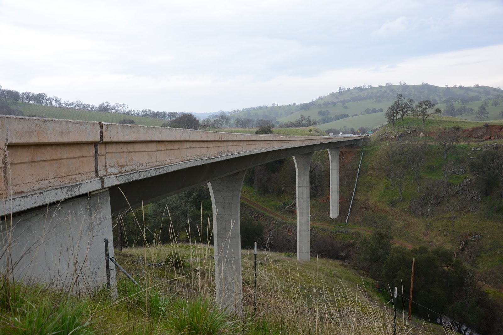
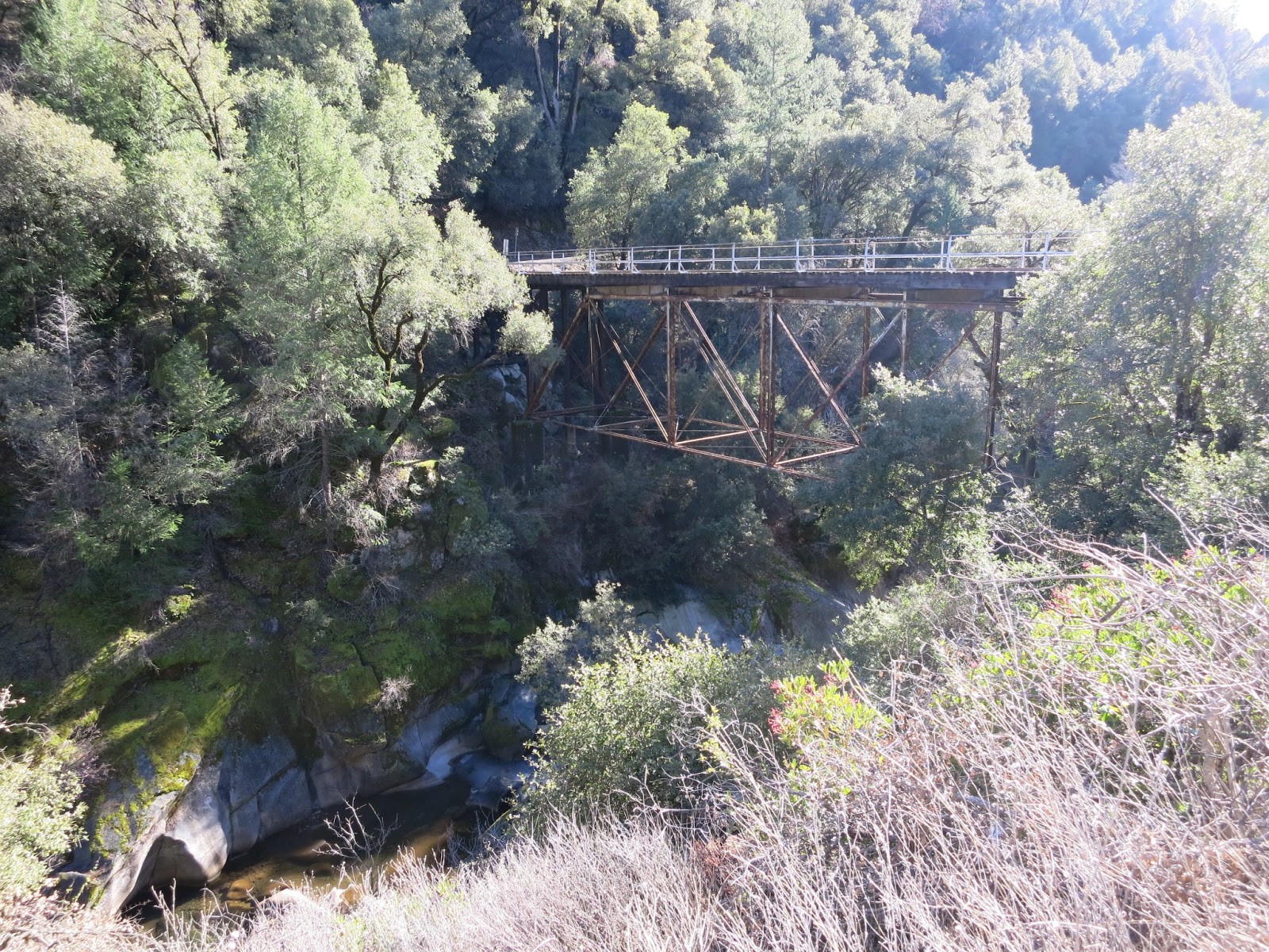
We've spent the last couple of weeks looking at bridges across the North and Middle Forks of the Cosumnes River. I've labeled the topo map below with the bridge locations:
1: Mount Aukum Bridge across the Middle Fork of the Cosumnes River (shown on 2/28 to 3/2).
2: Mira Paradis Drive Bridge across the Middle Fork of the Cosumnes River (shown on 3/3 to 3/4).
3: Rocky Bar Road Bridge across the Middle Fork of the Cosumnes River (shown on 3/5 to 3/6).
4: North South Road Bridges across the Middle Fork of the Consumnes River (shown on 3/7 to 3/9).
A: Sand Ridge Road Bridge across the North Fork of the Cosumnes River (shown on 3/10).
B: Buck's Bar Road Bridge across the North Fork of the Cosumnes River (shown 3/11, 3/12 and 3/18).
C: Mt Aukum Road Bridge across the North Fork of the Cosumnes River (shown on 3/13 to 3/14).
D: Happy Valley Road Bridge across the North Fork of the Cosumnes River (shown on 3/15).
E: Sweeney Road Bridge across the North Fork of the Cosumnes River (shown on 3/16).
F: Sciaroni Road Bridge across the North Fork of the Cosumnes River (shown on 3/17).
Creative Commons License
El Dorado County, California Bridges: Buck's Bar Road Bridge across the North Fork of the Cosumnes River (3) by Mark Yashinsky is licensed under a Creative Commons Attribution-NonCommercial-ShareAlike 3.0 United States License.

Sunday, March 17, 2013

El Dorado County, California Bridges: Sciaroni Road Bridge across the North Fork of the Cosumnes River

March 2013 (38.6689 Degrees, -120.5332 Degrees) Sciaroni Road Bridge
The first bridge across the North Fork of the Cosumnes River is an single span steel girder structure with a timber deck. The girders are supported on end bents in front of metal retaining structures. The girders have rivets supporting a diaphragm near the support. The bridge was built in 1965.
The river is very shallow and clear at this location. The Sciaroni Bridge is 79 ft long, about 10 ft longer than the Sweeney Road Bridge and about 40 ft longer than the Happy Valley Road Bridge downstream. The river starts off flat and wide before cutting through a stone canyon as it travels west through El Dorado County.
Creative Commons License
El Dorado County, California Bridges: Sciaroni Road Bridge across the North Fork of the Cosumnes River by Mark Yashinsky is licensed under a Creative Commons Attribution-NonCommercial-ShareAlike 3.0 United States License.

Saturday, March 16, 2013

El Dorado County, California Bridges: Sweeney Road Bridge across the North Fork of the Cosumnes River

February 2013 (38.6524 Degrees, -120.6258 Degrees) Sweeney Road Bridge
The next bridge across the North Fork of the Cosumnes River is a two span steel girder structure. This bridge and the previous Happy Valley Road Bridge get almost no traffic. I tried driving to this bridge from the south but Sweeney Road had a locked gate and a private property sign. I was able to get to the bridge from the north but there's no traffic since the road has a locked gate to the south.

Looking closely at this bridge you can see brackets on the exterior girder web, probably for a barrier rail that's now missing. Instead there is a flimsy looking rail on top of a very sturdy concrete curb. I wonder if a flood broke the handrails at the brackets?

The girders are tapered at the supports, just the opposite of what you would expect. Also, the girders have rivets which is strange for a bridge built in 1957. The girders are labeled 'Bettendorf Patent,' but I couldn't find any information about a fabricator named Bettendorf.

Each span is 32.5 ft long for a 67 ft long bridge, which is interesting since the Happy Valley Bridge downstream was only 37.5 ft long. The river has been freed from its stony banks at this location.
All the traffic and busy roads are to the west and people seem content to stay on one side of the river or the other in Eastern El Dorado County.
Creative Commons License
El Dorado County, California Bridges: Sweeney Road Bridge across the North Fork of the Cosumnes River by Mark Yashinsky is licensed under a Creative Commons Attribution-NonCommercial-ShareAlike 3.0 United States License.

Friday, March 15, 2013

El Dorado County, California Bridges: Happy Valley Road Bridge across the North Fork of the Cosumnes River

January 2013 (38.6540 Degrees, -120.6652 Degrees) Happy Valley Road Bridge
The next bridge over the North Fork of the Cosumnes River is just a single span structure due to the river narrowing as we move upstream.  The Happy Valley Road Bridge (25C0099) is a 37.5 ft long reinforced concrete girder and floor beam bridge that was built in 1936. The haunched superstructure sits on two seat-type abutments supported on the curved bedrock of the river bank. It looks like the bridge was painted a long time ago but no attempt was ever made to repeat this experiment. The approaches to the bridge are supported by a variety of concrete and masonry retaining structures. 
Creative Commons License
El Dorado County, California Bridges: Happy Valley Road Bridge across the North Fork of the Cosumnes River by Mark Yashinsky is licensed under a Creative Commons Attribution-NonCommercial-ShareAlike 3.0 United States License.