Saturday, November 30, 2013

Caltrans Toothpick Bridge Contest

Toothpick Bridges
For many years Caltrans Office of Structures Construction held a yearly contest to see who could build the strongest bridge out of a box of toothpicks, a few strips of balsa wood, and a small bottle of Elmer's glue. On the appointed day everyone turned in their bridges, which would be tested by hanging a plastic tub from the midspan supports and slowly filling it with sand. The winning engineer got their name on a plaque.

The rules became more and more difficult as the bridges became stronger and harder to break. The span became longer, the load was applied at two points on the bridge, and the bridge had to include a roadway that could carry a pingpong ball. About ten years ago Structures Construction stopped having the contest.
My entries never came close to winning. I always suspected the winning entry used more than the small bottle of glue that was provided. Either a tension member on my bridges would break or a compression member would buckle as the load got higher.
Creative Commons License
Caltrans Toothpick Bridge Contest by Mark Yashinsky is licensed under a Creative Commons Attribution-NonCommercial-NoDerivs 3.0 Unported License.

Friday, November 29, 2013

Osaka Prefecture, Japan's Bridges: Dojima River Bridge

November 2013 (34.6896 Degrees, 135.4849 Degrees) Dojima Ohashi
The Aji River splits into the Dojima and Tosabori at Nakanoshima, an island and the city center.  The Dojima Ohashi is a single span steel through arch bridge that carries Amida ike-suji Road. It was built in 1927 and supported at the abutments on hundreds of timber piles. This bridge was reportedly bombed during WWII although I couldn't see any signs of damage.
This bridge is so close to the water that river taxis and tour boats can't go under it. Therefore a plan to raise the bridge is underway that involves using shallower floor beams and a thinner bridge deck. The resulting smaller depth will provide an additional 1.25 m vertical clearance which is apparently for boats to pass under the bridge.
Looking downstream (in the photo above) from the Dojima Ohashi is the Hanshin Route 3 Kamifunatsu Bridges with utility bridges on either side. Looking upstream (in the photo below) is the two parallel Tamae Steel girder bridges on pier walls.
Creative Commons License
Osaka Prefecture, Japan's Bridges: Dojima River Bridge by Mark Yashinsky is licensed under a Creative Commons Attribution-NonCommercial-NoDerivs 3.0 Unported License.

Thursday, November 28, 2013

Osaka Prefecture, Japan Bridges: Yodogawa Bridges

November 2013 (34.6981 Degrees, 135.4718 Degrees) Yodogawa Bridges
The 808 bridges of Naniwa (Osaka) was so named because of its many rivers and many river crossings. Therefore, my last two blogs are about a few of the bridges that cross Osaka's rivers.

The Yodogawa is about half a mile wide and it's crossed by many beautiful bridges. The Yodogawa Ohashi (see photo above) is an elegant bridge built in 1926. It carries the Hanshin Route 2 with steel girder spans for the approach and Warren truss spans in the middle of the river.  It is supported on squat pier walls.
Connector ramps are being built on both sides of the Hanshin (Kobe) Route 3 Bridge (see photo above). All the superstructures are steel box girders and the substructures are big pier walls.
Between the Hanshin Route 2 and Route 3 Bridges is the Hanshin Mainline Railway Bridge composed of Warren Truss spans over the river. In the photo above we can see a Hanshin Express Model 8234 Electric Motorized Train (the cars have a red top and beige bottom) heading into Yodogawa Station. All the trains are instantly recognizable because of their distinctive colors.
In the Google earth photo above we can see the three bridges we just studied are near the mouth of the Yodogawa. The last bridges are the Denpo and Shin Denpo Bridges and the Hanshin (Wangan) Route 5 Bridge just beyond the river's mouth in Osaka Bay with two basket-handle arches along its length.
Creative Commons License
Osaka Prefecture, Japan Bridges: Yodogawa Bridges by Mark Yashinsky is licensed under a Creative Commons Attribution-NonCommercial-NoDerivs 3.0 Unported License.

Wednesday, November 27, 2013

Osaka Prefecture, Japan's Bridges: Hanshin Route 2 to Route 3 Interchange

November 2013 (34.6949 Degrees, 135.4649 Degrees) Route 2 to Route 3 Interchange
A new interchange connecting the Hanshin Expressway Route 2 (the Yodogawa Sagan Route) to the Hanshin Expressway Route 3 (the Kobe Route) has a tall pier composed of four steel pipes connected with steel shear links. This type of earthquake resisting element was used on the new East Bay Bridge that we looked at last month.
 The shear links are supposed to yield before the columns, reducing the column displacement and absorbing energy during the earthquake. However, these pipes are off the shelf with assorted imperfections (see photo above).
The shear links are composed of end pieces that are permanently attached to the pipes and a center piece that is meant to be damaged and replaced after the earthquake. It's an interesting concept but perhaps with too many parameters that could modify the intended behavior.
Another interesting thing about this interchange is all the extra bent caps and columns that aren't currently being used. It looks like eventually this interchange will become as complicated as yesterday's Matsubara Junction.
Creative Commons License
Osaka Prefecture, Japan's Bridges: Hanshin Route 2 to Route 3 Interchange by Mark Yashinsky is licensed under a Creative Commons Attribution-NonCommercial-NoDerivs 3.0 Unported License.

Tuesday, November 26, 2013

Osaka Prefecture, Japan's Bridges; Matsubara Interchange

November 2013 (34.6000 Degrees, 135.46212 Degrees) Yamatogawa Expressway
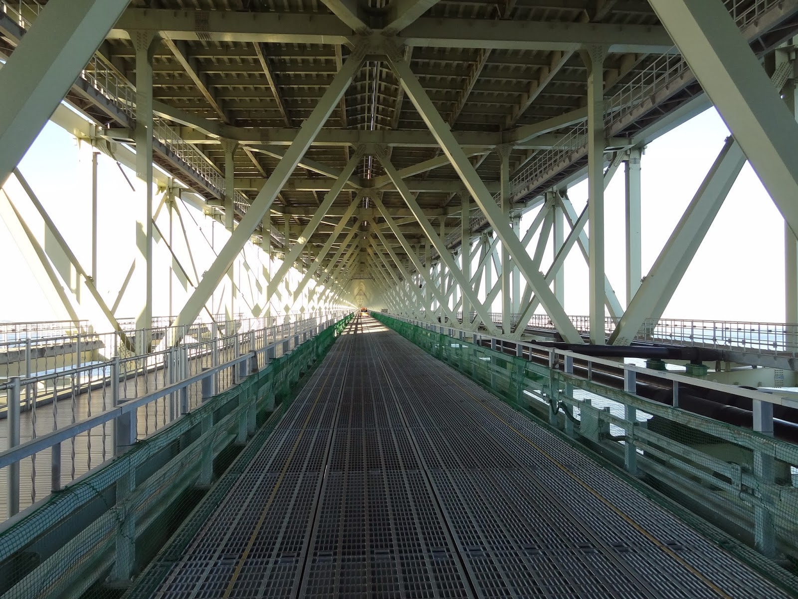
After visiting the Higashi-Kobe Bridge we drove east to the Matsubara Interchange on the Yamatogawa Expressway Project. This part of Osaka has become so congested that they are building a ring road to relieve the gridlock (see map below). The Yamatogawa Route is a 9.7 km expressway linking the Hanshin Expressway Route 4 (Wangan Route) and the Matsubara Route 14. It was originally planned to built the Yamatogawa Route as a cut and cover tunnel but because of the many obstacles like railroad tracks, water treatment plants, etc., it was eventually decided to make it a shield tunnel except for the ramp connectors. Also, some culvert-like tunnels are being constructed using an underground launching procedure. 
Work on this project began in 1999 and it's still continuing. The work is complicated by the Uemachi and several other faults that go under the tunnels and bridges. They said they were designing the structures for the resulting ground shaking, but I'm not sure if they were designed for the resulting fault offset.
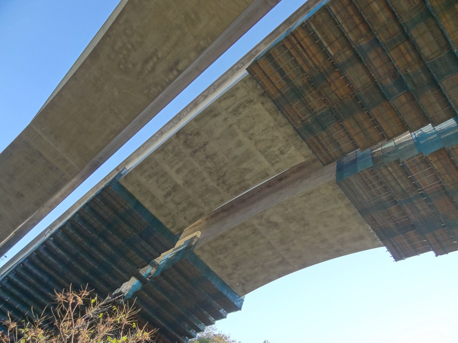
In the photo above we can see part of the interchange as well as the Yamatogawa (Cable-Stayed) Bridge in the background that we studied in 2009. Somehow, there's even room for an incinerator. Note the large catchment basin in the middle of the interchange. They said the basin is going to remain after the interchange is complete, perhaps for drainage. Holding the megaphone is our very patient interpreter, Iva carrying her megaphone. Note that they gave us white gloves and hardhats to wear at every construction site.
Creative Commons License
Osaka Prefecture, Japan's Bridges; Matsubara Interchange by Mark Yashinsky is licensed under a Creative Commons Attribution-NonCommercial-NoDerivs 3.0 Unported License.

Monday, November 25, 2013

Hyogo Prefecture, Japan Bridges: Higashi-Kobe Bridge

November 2013 (34.7095 Degrees, 135.2894 Degrees) Higashi-Kobe Bridge
We studied the Higashi-Kobe Bridge after the 1995 Kobe earthquake and on several other visits to Japan. It's a 885m long cable-stayed bridge with a 485m long main span and with 147m tall towers. This bridge was damaged by the earthquake eight months after it opened.
The superstructure is a double-deck Warren truss that is attached to wind dampers at the towers and to vane dampers and eyebars at the ends of the truss. All of these attachments broke during the Kobe earthquake.
The bridge is part of the Wangan Expressway, which sits on artificial islands between Kobe and Osaka along Osaka Bay.
Creative Commons License
Hyogo Prefecture, Japan Bridges: Higashi-Kobe Bridge by Mark Yashinsky is licensed under a Creative Commons Attribution-NonCommercial-NoDerivs 3.0 Unported License.

Sunday, November 24, 2013

Hyogo Prefecture, Japan Bridges: Hanshin Expressway Earthquake Museum

November 2013 (34.71071 Degrees, 135.29299 Degrees) Hanshin Expressway Earthquake Museum
The next morning was the first rainy day of our trip. We drove under the Higashi Kobe Cable-Stayed Bridge to visit the Hanshin Expressway Earthquake Museum. As I've previously mentioned, Japan does a good job of providing a record (and a reminder) of natural disasters. There are four museums related to the Kobe earthquake: a museum on sociological aspects, a museum on building damage, a museum built over the fault on Awaji Island, and this museum that shows bridge damage.
Among the exhibits is a steel box girder superstructure that was damaged when it fell off its bearings. We were able to look inside and see how the stiffeners had buckled.
Another specimen shows a steel bridge column that buckled in compression as the column moved to the south and then tore when the column was jerked back to the north. The buckle occurred where the thickness of the steel was reduced at mid-height.
A third exhibit shows a concrete column that was damaged where the longitudinal reinforcement was cut-off at mid-height. Many of the exhibits showed damage where the strength and/or stiffness of a member had been changed.
Creative Commons License
Hyogo Prefecture, Japan Bridges: Hanshin Expressway Earthquake Museum by Mark Yashinsky is licensed under a Creative Commons Attribution-NonCommercial-NoDerivs 3.0 Unported License.

Saturday, November 23, 2013

Hyogo Prefecture, Japan Bridges: Port-Liner Elevated Railway in Downtown Kobe

November 2013 (34.69517 Degrees, 135.19599 Degrees) Port-Liner Elevated Railway
After visiting the Akashi Kaikyo Bridge we checked into our hotel in Kobe and walked to a nearby restaurant for dinner. In these photos we are walking under the Port-Liner Elevated Railway which turns southeast from Sannomiya Station through downtown Kobe towards Port Island. This area had a great deal of damage during the 1995 Kobe earthquake and I managed to snap a few photos of the many improvements with my iPhone.
The bridges have been retrofitted with steel column casings and viscous fluid dampers, which will hopefully prevent severe damage during the next earthquake. However, the use of 'C' Bents and short radius curves will result in large superstructure displacements and large torsional and flexural moments in the supports.
Creative Commons License
Hyogo Prefecture, Japan Bridges: Port-Liner Elevated Railway in Downtown Kobe by Mark Yashinsky is licensed under a Creative Commons Attribution-NonCommercial-NoDerivs 3.0 Unported License.

Friday, November 22, 2013

Hyogo Prefecture, Japan Bridges: Akashi Kaikyo Bridge across the Akashi Strait (5)

November 2013 (34.616389 Degrees, 135.020278 Degrees) Akashi Kaikyo Bridge
One last photo of the Akashi Kaikyo Bridge from Awaji Island. They've built an enormous park around the bridge that helped to gain support for this expensive bridge project. On the other side of the bridge is the City of Kobe, which we'll visit tomorrow.
Creative Commons License
Hyogo Prefecture, Japan Bridges: Akashi Kaikyo Bridge across the Akashi Strait (5) by Mark Yashinsky is licensed under a Creative Commons Attribution-NonCommercial-NoDerivs 3.0 Unported License.

Thursday, November 21, 2013

Hyogo Prefecture, Japan Bridges: Akashi Kaikyo Bridge across the Akashi Strait (4)

November 2013 (34.616389 Degrees, 135.020278 Degrees) Akashi Kaikyo Bridge

At the northern end of Awaji Island is the Akashi Kaikyo Bridge with the longest main span of any bridge in the world. This bridge has 960m long side spans and a 1991m main span (1990m before the Kobe earthquake). We previously studied this bridge in July of 2009.
Below the deck is a catwalk that was designed to carry trucks. It took us ten minutes to walk from the anchorage to the first tower, so being able to drive under this bridge is a huge asset.
The elevator takes two minutes to get to the top of the 300m high tower. The elevator has to change position as it rolls along the tower legs. We were warned not to take photos using an iPhone because they're hard to hold onto and if you drop it, you could kill someone on the bridge deck below. Note only a single pair of suspender cables support each end of the floor beams instead of the four on the hefty Onaruto Bridge at the south end of Awaji Island.

We'll take a final look at this iconic bridge tomorrow.
Creative Commons License
Hyogo Prefecture, Japan Bridges: Akashi Kaikyo Bridge across the Akashi Strait (4) by Mark Yashinsky is licensed under a Creative Commons Attribution-NonCommercial-NoDerivs 3.0 Unported License.

Wednesday, November 20, 2013

Hyogo Prefecture, Japan Bridges: Awaji Island Bridges

November 2013 Awaji Island Bridges
There are a number of interesting bridges near the north end of Awaji Island. In order to keep the Honshu-Shikoku Expressway open, many of these bridges are currently being retrofitted. For instance, The arches of three parallel bridges are being strengthened to remain elastic for the strongest ground shaking caused by a rupture on the nearby Nojima Fault (which caused the 1995 Kobe Earthquake).
Because the arches are shear critical for ground shaking, the Honshu-Shikoku Expressway Corporation deepened the ribs by about a meter and added transverse reinforcement.
Besides several arch bridges, there are also bridges supported by 'V' shaped bents and even fluted columns.
Creative Commons License
Hyogo Prefecture, Japan Bridges: Awaji Island Bridges by Mark Yashinsky is licensed under a Creative Commons Attribution-NonCommercial-NoDerivs 3.0 Unported License.

Tuesday, November 19, 2013

Tokushima Prefecture, Japan Bridges: Ōnaruto Bridge across the Naruto Strait (2)

November 2013 (34.2461 Degrees, 134.6670 Degrees) Ōnaruto Bridge
Continuing north we arrived at the Naruto Strait and the Ōnaruto Bridge. The Naruto Strait (鳴門海峡) has dangerous whirlpools and eddies, which are imaginatively rendered in the folk dances of the region. The Strait separates Shikoku Island from Awaji Island and it's crossed by the Ōnaruto Bridge.
Originally, they were planning to carry the Shinkansen (bullet train) on the bottom bridge decks of the Kobe-Awaji-Naruto Expressway. Eventually it was decided to carry trains on the Seto-Chuo Expressway instead and the bottom deck is used to carry maintenance crews and visitors under the bridge. Tourists can watch ships navigating around the rocks and swift current under the bridge. However, the bridge was designed so it could still carry the Shinkansen in the future. Also, the number of traffic lanes could be increased from four to six lanes, but as can be seen in the photo above, there is almost no traffic on this bridge.
Because of the hostile environment at the Naruto Strait, everything about this bridge was made extra strong. For instance, instead of two suspenders hanging from the suspension cable at each floor beam, the Ōnaruto Bridge has four suspenders so that two can be replaced at a time. Because of the hard rock and swift current under the Naruto Strait, the towers and pier are supported on large diameter pile caps instead of caissons.
The suspension cables were constructed with extra strands to balance the tension in the side tower that supports the short truss span at the end of the bridge. Also, larger diameter wires (5.37mm) were used for the suspension cables.
Creative Commons License
Tokushima Prefecture, Japan Bridges: Ōnaruto Bridge across the Naruto Strait (2) by Mark Yashinsky is licensed under a Creative Commons Attribution-NonCommercial-NoDerivs 3.0 Unported License.