Thursday, July 31, 2014

San Francisco County, California Bridges: Illinois Street Bridge across Islais Creek

July 2014 (37.74740, -122.38617) Illinois Street Bridge
The last movable bridge in San Francisco County is the Illinois Street Bridge. Sitting one block away from yesterday's Third Street Bridge, it is a single leaf bascule bridge without counterweights. Instead, the bridge is raised and lowered by hydraulic cylinders that pull and push on lever arms connected to the steel deck. Perhaps this is the future for bascule bridges? It was built in 2006 by Shimmick Construction and others. It doesn't have a county bridge number because it's owned by Bay Area Rapid Transit (BART). It was built between San Francisco Port's north and south terminals, mainly for trucks, but also with sidewalks for bikes and pedestrians and with rails for freight trains.  
Creative Commons License
San Francisco County, California Bridges: Illinois Street Bridge across Islais Creek by Mark Yashinsky is licensed under a Creative Commons Attribution-NonCommercial-NoDerivatives 4.0 International License.

Wednesday, July 30, 2014

San Francisco County, California Bridges: Third Street Bridge across Islais Creek

July 2014 (37.74694 Degrees, -122.38694 Degrees) Third Street Bridge
Today's bridge is also on Third Street but several miles to the south across Islais Creek. It's called the Levon Hagop Nishkian Bridge (34C0024) after the senior member of a family of civil engineers that have practiced in San Francisco for the last 100 years. It is a double leaf bascule bridge that was built in 1945. Some nice photos of Islais Creek and the bridge (taken just after the Second World War) are on this website. An unusual aspect of the bridge is the art deco style of the bridge tender's house and of the shiny silver-painted covers over the arms supporting the counterweights, which are under the bridge. The bridge also has overhead catenary cables and tracks for the trolleys (owned by Caltrain) that cross the bridge.
Creative Commons License
San Francisco County, California Bridges: Third Street Bridge across Islais Creek by Mark Yashinsky is licensed under a Creative Commons Attribution-NonCommercial-NoDerivatives 4.0 International License.

Tuesday, July 29, 2014

San Francisco County, California Bridges: Fourth Street Bridge across China Basin

July 2014 (37.77495 Degrees, -122.39230 Degrees) Fourth Street Bridge
The Fourth Street (Peter R. Maloney) Bridge (34C0027) is just a block away from yesterday's bridge. It was originally a heel trunnion bascule bridge similar to it's neighbor. However, after the 1989 Loma Prieta Earthquake they removed the 1.4 million pound counterweight above the bridge and replaced it with a mainly decorative 100,000 pound weight. A new counterweight was then placed in a pit under the road to raise and lower the bridge. 

During the next earthquake, the much lighter, decorative weight can be securely supported without damaging the bridge while the new counterweight is prevented from moving. This bridge was built in 1917 and retrofitted between 2003 and 2006.
Creative Commons License
San Francisco County, California Bridges: Fourth Street Bridge across China Basin by Mark Yashinsky is licensed under a Creative Commons Attribution-NonCommercial-NoDerivatives 4.0 International License.

Monday, July 28, 2014

San Francisco County, California Bridges: Third Street Bridge across China Basin

July 2014 (37.77694 Bridges-122.39000 Bridges) Third Street Bridge
We've left San Mateo County for tiny San Francisco County at the top of the peninsula. Besides the Bay Bridge and the Golden Gate Bridge there are just a few other iconic bridges in the county. Four interesting bascule bridges are located on the east side of San Francisco along the Bay. 

The Third Street (Lefty O'Dowd) Bridge (34C0025) is next to the AT&T Baseball Park in China Basin. It's a Strauss Heel Trunion Single Leaf Bascule Bridge that was built in 1932. These bridges are interesting to watch open and close. In order for the leaf span to be lifted high in the air, the arms that hold the counterweight fold up and rotate the weight out of the way of the approaching roadway. There are several nice videos on Youtube showing the bridge opening and closing. The bridge also has an unusual split counterweight. 
Creative Commons License
San Francisco County, California Bridges: Third Street Bridge across China Basin by Mark Yashinsky is licensed under a Creative Commons Attribution-NonCommercial-NoDerivatives 4.0 International License.

Sunday, July 27, 2014

San Mateo County, California Bridges: Rte 35/1 and Rte 35/280 Interchanges

July 2014 (37.667 Degrees, -122.485 Degrees) Rte 35/1 and Rte 35/280 Interchanges
Going north on Highway 1 to San Francisco I drove under two big interchanges. First I crossed under the South Connector (35 0204F) on the Route 35/1 Interchange. A few minutes later, I was crossing under the D Street On-Ramp (35 0315K) on the Route 35/280 Interchange. Unfortunately these photos (taken through my windshield) don't do justice to the beauty of these modern highways. Caltrans does a great job of landscaping, especially for its routes along the coast. 
Creative Commons License
San Mateo County, California Bridges: Rte 35/1 and Rte 35/280 Interchanges by Mark Yashinsky is licensed under a Creative Commons Attribution-NonCommercial-NoDerivatives 4.0 International License.

Saturday, July 26, 2014

San Mateo County, California Bridges: Sierra Point Overhead over Caltrain Tracks (3)

July 2014 (37.67422 Degrees, -122.38935 Degrees) Sierra Point OH
In Caltrans' nomenclature an overhead is a bridge that carries a highway over a railway. Overheads are required to have crashwalls which make perfect canvases for graffiti artists. The crashwalls on the Sierra Point Overhead show a variety of graffiti styles. It's nice how each artist made their contribution fit within the whole (and it's nice that Caltrans didn't paint over everything).
Creative Commons License
San Mateo County, California Bridges: Sierra Point Overhead over Caltrain Tracks (3) by Mark Yashinsky is licensed under a Creative Commons Attribution-NonCommercial-NoDerivatives 4.0 International License.

Friday, July 25, 2014

San Mateo County, California Bridges: Northwest Connector of the Route 92/101 Interchange

January 1990 (37.5533 Degrees, -122.295 Degrees) Route 92/101 Interchange
The Route 92/101 Interchange was begun in 1971 but it wasn't completed until 1986 due to a lack of funding for highway projects during the first Jerry Brown administration. He was very idealistic in those days and wanted to change the way people traveled. The interchange carries traffic onto the San Mateo Bridge to the west and onto Route 101 and San Francisco to the north.

The Northwest Connector (shown above) consists of three frames (600', 700', 450') supported on single column bents.The superstructure is a prestressed concrete box with two vertical, interior girders and two sloping exterior girders. This bridge has a long swooping shape that reminds me of a brontosaurus. 
Creative Commons License
San Mateo County, California Bridges: Northwest Connector of the Route 92/101 Interchange by Mark Yashinsky is licensed under a Creative Commons Attribution-NonCommercial-NoDerivatives 4.0 International License.

Thursday, July 24, 2014

San Mateo County, California Bridges: Crystal Springs Road Bridge across San Mateo Creek

July 2014 (37.54194 Degrees-122.34889 Degrees) Crystal Springs Road Bridge
Back to the City of San Mateo and a few last arch bridges. The Crystal Springs Road Bridge (35C0037) over San Mateo Creek is a 40 ft closed spandrel arch that was built in 1904. 

I wonder why arch bridges were so popular 110 years ago. They seem like a poor choice since they restrict the stream flow and cause flooding upstream. Today an inexpensive bridge for a 40 ft span would be a nice shallow reinforced concrete slab.
Creative Commons License
San Mateo County, California Bridges: Crystal Springs Road Bridge across San Mateo Creek by Mark Yashinsky is licensed under a Creative Commons Attribution-NonCommercial-NoDerivatives 4.0 International License.

Wednesday, July 23, 2014

San Mateo County, California Bridges: Stafford Street Bridge across Cordilleras Creek

July 2014 (37.49449 Degrees-122.24439 Degrees) Stafford Street Bridge
Heading east from Woodside I arrived in Redwood City and another old concrete arch bridge. The Stafford Street Bridge (35C0050) is a concrete arch on a high skew that's been painted light blue. The barriers include posts on just one end and also plaques that read "Clark and Henery - 1903 - Stockton, California." The bridge crosses over Cordilleras Creek next to a set of railroad tracks that also go over the creek on a short arch bridge.
Creative Commons License
San Mateo County, California Bridges: Stafford Street Bridge across Cordilleras Creek by Mark Yashinsky is licensed under a Creative Commons Attribution-NonCommercial-NoDerivatives 4.0 International License.

Tuesday, July 22, 2014

San Mateo County, California Bridges: Mountain Home Road Bridge across Bear Creek

July 2014 (37.42688 Degrees-122.25355 Degrees) Mountain Home Road Bridge
The bridges we are currently studying were all built near the town of Woodside in 1903 and are very similar. They're short concrete arches with wingwalls and barriers formed as extensions to the spandrel walls. Note the bags of hardened concrete used to protect the abutment foundations from scour. Similar to yesterday's King Mountain Road Bridge there is a timber walkway erected to carry equestrians due to the narrow bridge deck. The Mountain Home Road Bridge (35C0122) is also eligible for the National Register of Historic Places. There's a plaque next to the timber bridge to honor the late Dale Ryman, a former Caltrans engineer who built many equestrian bridges next to roadway bridges in the region (see photo below).
Creative Commons License
San Mateo County, California Bridges: Mountain Home Road Bridge across Bear Creek by Mark Yashinsky is licensed under a Creative Commons Attribution-NonCommercial-NoDerivatives 4.0 International License.

Monday, July 21, 2014

San Mateo County, California Bridges: Kings Mountain Road Bridge across West Union Creek

July 2014 (37.43083 Degrees, -122.27583 Degrees) Kings Mountain Road Bridge
San Mateo County can be divided between bay, mountain, and coastal regions. We are leaving the coast for the mountains and some old mossy bridges. The Kings Mountain Road Bridge (35C0123) is a closed spandrel arch over West Union Creek. It was built in 1905 and it's eligible for the National Register of Historic Places. Among its features are massive barrier rails with handsome end posts and a timber walkway on its own supports along the south spandrel wall. 
Creative Commons License
San Mateo County, California Bridges: Kings Mountain Road Bridge across West Union Creek by Mark Yashinsky is licensed under a Creative Commons Attribution-NonCommercial-NoDerivatives 4.0 International License.

Sunday, July 20, 2014

San Mateo County, California Bridges: State Route 1 across Pescadero Creek (2)

July 2014 (37.266824 Degrees, -122.411248 Degrees) Pescadero Creek Bridge
The Pescadero Creek Bridge (35 0028) is a 3 span 380 ft long structure that was built in 1991. It replaced a previous bridge built in the 1940s that was further upstream and had more piers that interfered with stream flow. The current bridge was built with only two columns and close to the ocean to minimize its impact upstream. Pescadero Creek used to carry steelhead and salmon but it has degraded over the last 100 years due to logging and development. 
Creative Commons License
San Mateo County, California Bridges: State Route 1 across Pescadero Creek (2) by Mark Yashinsky is licensed under a Creative Commons Attribution-NonCommercial-NoDerivatives 4.0 International License.


Saturday, July 19, 2014

San Mateo County, California Bridges: State Route 1 across Pescadero Creek (1)

July 2014 (37.266824 Degrees, -122.411248 Degrees) Pescadero Creek Bridge
Continuing south along the coast I arrived at the Pescadero Creek Bridge (35 0028). When I was in Caltrans Bridge Design Branch 1 our boss Ted Roworth encouraged us to think outside the box. Emil Vergara took advantage of this openness to design a bridge that was more sculptural in form. Felix Wong, who was in Caltrans Aesthetics Branch worked with Emil to achieve this unique design. I also recall that Brian Jesse helped make the piers work for the high seismic demands along the coast.

Creative Commons License
San Mateo County, California Bridges: State Route 1 across Pescadero Creek (1) by Mark Yashinsky is licensed under a Creative Commons Attribution-NonCommercial-NoDerivatives 4.0 International License.

Friday, July 18, 2014

San Mateo County, California Bridges: State Route 1 Bridge across San Gregorio Creek (2)

July 2014 (37.32083 Degrees-122.40194 Degrees) San Gregorio Creek Bridge
Continuing south along the coast I came to the San Gregorio Bridge (35 0030). You may recall that we visited this bridge last week and at that time I showed a photo from 1991. The bridge looks pretty much the same. Its a 5 span, 266 ft long haunched T girder bridge that was built in 1941. Open barrier rails have always been popular for bridges along the Pacific Coast.
Creative Commons License
San Mateo County, California Bridges: State Route 1 Bridge across San Gregorio Creek (2) by Mark Yashinsky is licensed under a Creative Commons Attribution-NonCommercial-NoDerivatives 4.0 International License.

Thursday, July 17, 2014

San Mateo County, California Bridges: Cabrillo Highway Bridge across Tunitas Creek

July 2014 (37.35664 Degrees, -122.39707 Degrees) Tunitas Creek Bridge
As I continued to travel south along the coast I came to the Cabrillo Highway Bridge (35 0031) across Tunitas Creek. It is a six span precast girder bridge built in 1962 and seismically retrofitted in 1994. As I climbed down the embankment to photograph the substructure I came upon a young man decorating a bent with several cans of spray paint. 
Creative Commons License
San Mateo County, California Bridges: Cabrillo Highway Bridge across Tunitas Creek by Mark Yashinsky is licensed under a Creative Commons Attribution-NonCommercial-ShareAlike 3.0 United States License.

Wednesday, July 16, 2014

San Mateo County, California Bridges: Arroyo de en Medio Bridge

July 2014 (37.49335 Degrees-122.45978 Degrees) Arroyo de en Medio Bridge
A little south of Devil's Slide in Half Moon Bay is a damaged concrete arch bridge. A prefabricated Corten pony truss bridge was laid on top. This pedestrian bridge carries the Half Moon Bay Coastal Trail over Arroyo de en Medio along the beach. 
Creative Commons License
San Mateo County, California Bridges: Arroyo de en Medio Bridge by Mark Yashinsky is licensed under a Creative Commons Attribution-NonCommercial-NoDerivatives 4.0 International License.

Tuesday, July 15, 2014

San Mateo County, California Bridges: Devil's Slide Bridges across Shamrock Ranch Valley

July 2014 (37.58397 Degrees-122.50911 Degrees) Devil's Slide Bridge
State Route 1 provides access to the headlands and beaches along the Pacific Coast at considerable cost to the state of California. The slow process of erosion is accelerated along the coast and SR 1 requires considerable resources to keep open.  The Devil's Slide just south of San Francisco was deteriorating so rapidly that Caltrans eventually drilled a tunnel through the headlands to avoid it. Caltrans' engineer Kevin Harper designed the two handsome arch bridges that cross the valley at Shamrock Ranch on the north side of the tunnel (Pat Hipley and I designed the retaining wall along the entrance to the tunnel).
Creative Commons License
San Mateo County, California Bridges: Devil's Slide Bridges across Shamrock Ranch Valley by Mark Yashinsky is licensed under a Creative Commons Attribution-NonCommercial-NoDerivatives 4.0 International License.

Monday, July 14, 2014

San Mateo County, California Bridges: Sierra Point Overhead over Caltrain Tracks (2)

July 2014 (37.67422 Degrees, -122.38935 Degrees) Sierra Point OH
This bridge, built in 1957, carries Highway 101 over railroad tracks (and Sierra Point Parkway) in South San Francisco. It's a 10-span steel girder bridge, with girders supported by steel floor beams. One end of each girder is bolted to a floor beam stiffener, and the other end was originally attached to a rocker bearing on top of a short seat on the floor beam. The floor beams are supported by 2–4 nonductile reinforced concrete columns. Originally, steel bearings sat atop the columns and were welded to the floor beams. The columns are supported by under-reinforced spread footings on stiff clay. The bridge abutments are on a 60° skew parallel to the railroad tracks, but the bents have no skew. This interesting configuration results in some floor beams being supported by the abutments. 
The bridge site has a 0.4g PGA and is about 16 km from the Mw=8.0 San Andreas Fault. The weak columns and poorly reinforced footings leave the bridge vulnerable to the earthquakes that frequently strike the San Francisco Bay Area. However, the proximity of the railroad limited the retrofit options. Therefore, this bridge was retrofitted with isolation bearings in 1985, making it the first isolated bridge in the United States. All the bearings at the columns and at the abutments were replaced by lead/rubber bearings, which were designed so that the seismic forces would be less than the capacity of the columns and footings. These lead/rubber bearings are rectangular, but round lead/rubber bearings are now used in other bridges because they provide much better performance, particularly for bridges that must move in all directions. To prevent the rocker-supported end of the steel girders from becoming unseated, 2.2-cm steel tie rods were used to connect them to the bolted girders on the other side of the floor beams.
After the retrofit, the bridge was instrumented with strong-motion accelerometers above and below the isolators. The epicenter of the 1989 Loma Prieta earthquake was about 100 km from the bridge site, and the measured acceleration at the bridge was 0.29g above the isolators and 0.31g below the isolators (parallel to the bridge). These two accelerations are about the same, which shows that the lead core did not yield during the earthquake and the bridge behaved elastically with no damage.
Creative Commons License
San Mateo County, California Bridges: Sierra Point Overhead over Caltrain Tracks (2) by Mark Yashinsky is licensed under a Creative Commons Attribution-NonCommercial-NoDerivatives 4.0 International License.

Sunday, July 13, 2014

San Mateo County, California Bridges: Sierra Point Overhead over Caltrain Tracks (1)

August 1991 (37.674219 Degrees, -122.389354 Degrees) Sierra Point Overhead
The Sierra Point Overhead was the first bridge to be seismically isolated in the United States. It's a 10-span steel girder bridge built in 1957 and carrying State Route 101. The bridge is on such a high skew that the floor beams sit on pile extensions and the abutments. The columns (on spread footings) were not designed for strong earthquakes (it's 10 miles from the San Andreas Fault) and so it was retrofitted in 1985 with lead rubber bearings to reduce the inertia force to the substructure.
Creative Commons License
San Mateo County, California Bridges: Sierra Point Overhead over Caltrain Tracks (1) by Mark Yashinsky is licensed under a Creative Commons Attribution-NonCommercial-NoDerivatives 4.0 International License.

Saturday, July 12, 2014

San Mateo County, California Bridges: State Route 280 Bridge across San Mateo Creek

September 2009 (37.53000-122.36000) San Mateo Creek Bridge
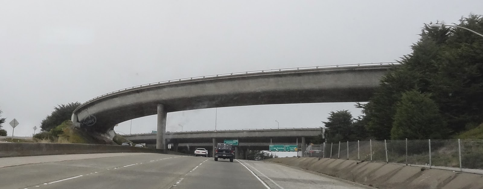
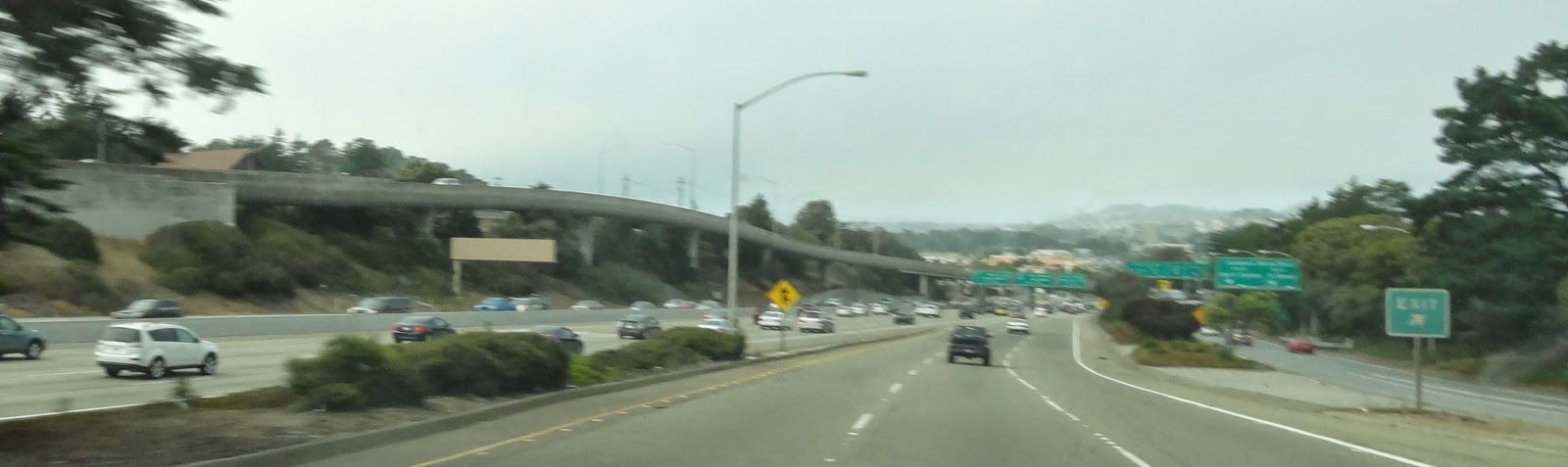
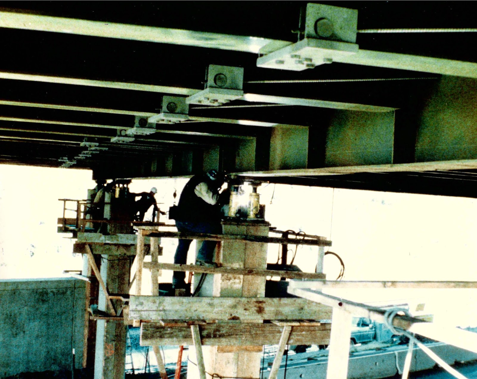
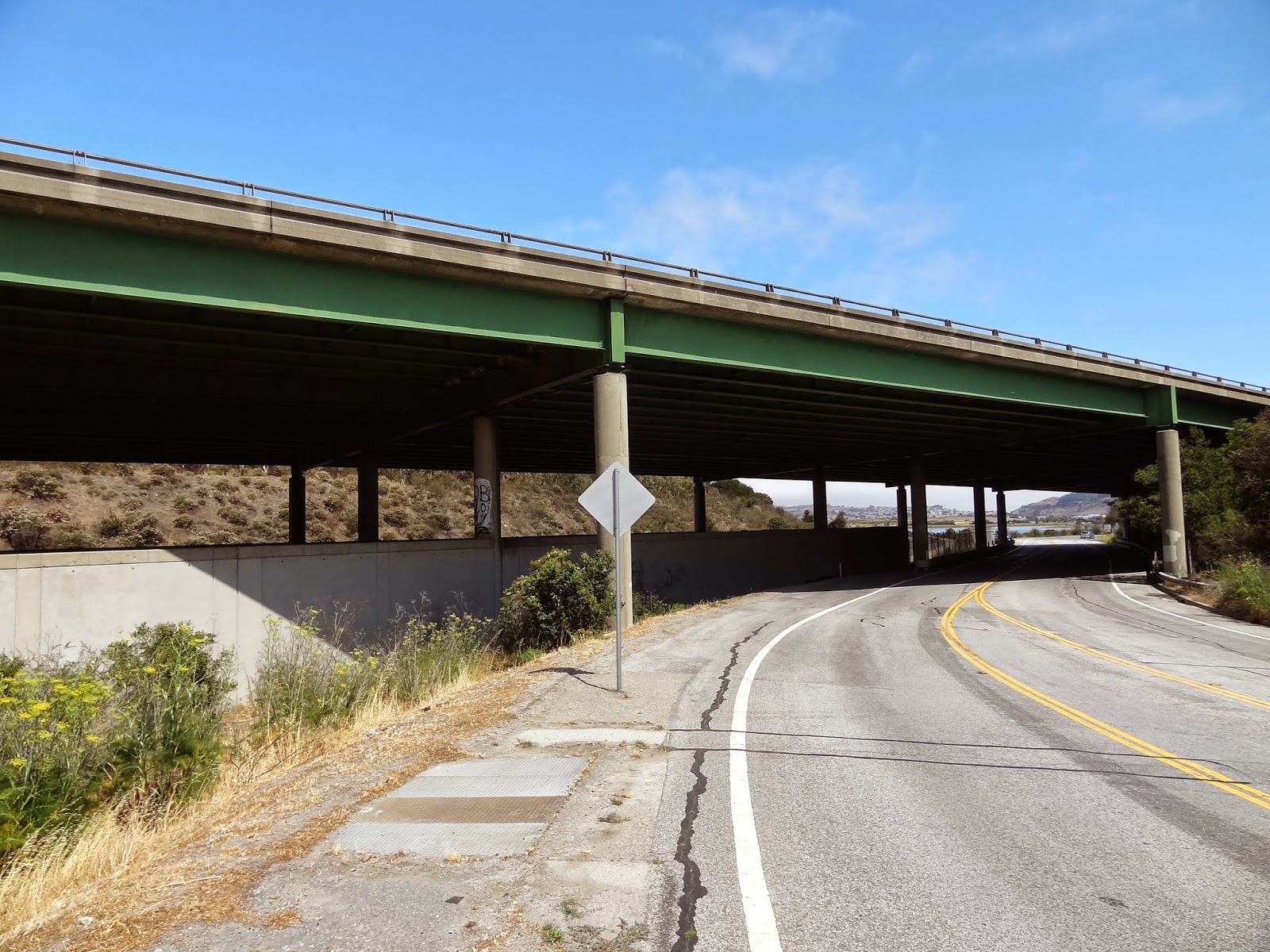
We last studied the San Mateo Creek Bridge (35 0199) in 2010. It is a continuous five span steel I girder bridge that was built in 1967. There was considerable attention paid to the aesthetics of this bridge. The Happy Pontist wrote in 2010 that the Italian structural engineer Pier Nervi came to California in the 1960s and worked on several bridge designs including the San Mateo Creek Bridge. Note in the figure below how Nervi designed the columns to twist 90 degrees so they are stiffer transversely at the top and stiffer longitudinally at the bottom. The bottom includes a one-way pin that allows the columns to rotate transversely while remaining fixed for longitudinal motion. Thus the columns are made stronger for the large transverse moments at the top and for the large longitudinal moments at the bottom. 
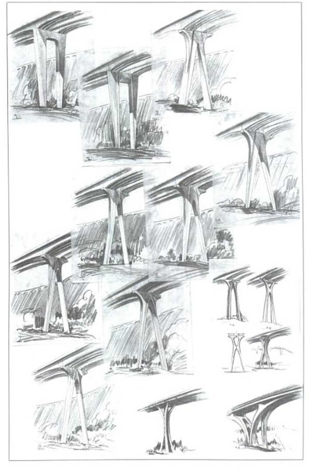
Arthur Elliott in his book 'Bridge Aesthetics around the World' showed many sketches for the design of the piers on the San Mateo Creek Bridge. However, in most of these drawings and in the completed bridge the piers don't look sufficiently integrated to the superstructure. 
Creative Commons License
San Mateo County, California Bridges: State Route 280 Bridge across San Mateo Creek by Mark Yashinsky is licensed under a Creative Commons Attribution-NonCommercial-NoDerivatives 4.0 International License.